The primary mission of the Friends of the Trails organization is to build hiking trails in Cumberland County. Our priority is to build a network of natural hiking trails around the city known as the “Crossville Greenway.”Initially this will be natural dirt trails but, hopefully, over time they will be upgraded to wide multi-purpose paved trails.
The Greenway master plan
We have been working for some time on a master plan for the Greenway that captures the current state of hiking trails in Cumberland Couty and details the future plans. This 26-page plan was published on April 4th, 2021.
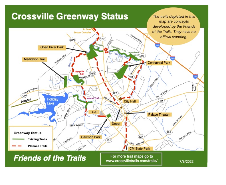
This is an overview vision of the project. The maps show the existing and planned trails around the city. The planned network of natural trails will circle the city providing a green corridor connecting recreational centers.
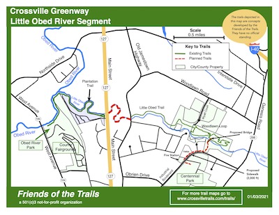
The Little Obed River Segment
This trail will connect Centennial Park to the Obed River Park.
1.1. The Little Obed River Segment
When complete this will provide a leafy corridor along beside the Little Obed River from Centennial Park all the way to the Obed River Park on Route 70 North.
The existing sections include the Woodlawn Loop and the Little Obed River Trail to Old Jamestown Highway. Also the Charleston Place Trail (currently closed) and the paved trails in he Obed River Park. Finally there are paved trails around Centennial Park.
The City of Crossville has received a grant to pave part of this segment. In the first half of 2026 they plan to installl a bridge over the Little Obed River as part of the connection between Woodlawn Loop and Centennial Park.
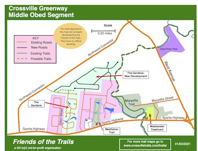
The Middle Obed River Segment
This segment will connect the Obed River Park to Sparta Highway.
2.2. The Middle Obed River Segment
This Segment follows the Obed River. Travelling upstream from the Obed River Park to Sparta Highway at the Maryetta Trail-head.
The Maryetta Trail forms part of this segment and most of the property between the Maryetta Trail and the Obed River Park is owned by the Norris Brothers. Some discussion have taken place about getting permission to build a trail on their property but no ageement has been reached.
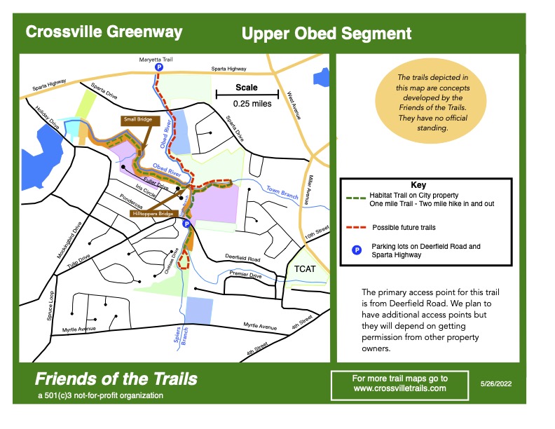
The Upper Obed River Segment
This segment will connect Sparta Highway to Garrison Park
2.3. The Upper Obed River Segment
This Segment follows the Obed River. Traveling Upstream from Sparta Highway and along the Spiers Branch Creek to Deerfield Road. The Habitat Trail is contained within this segment.
Discussion are far advanced with St Alphonsus Church to get permission to extend the Habitat Trail along the Obed River on church property. Construction may begin in 2026.
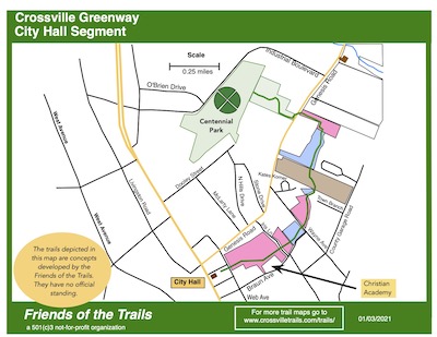
The City Hall Segment
This segment will connect City Hall to Centennial Park
2.4. The City Hall Segment
This Segment starts at City Hall and ends at Centennial Park.
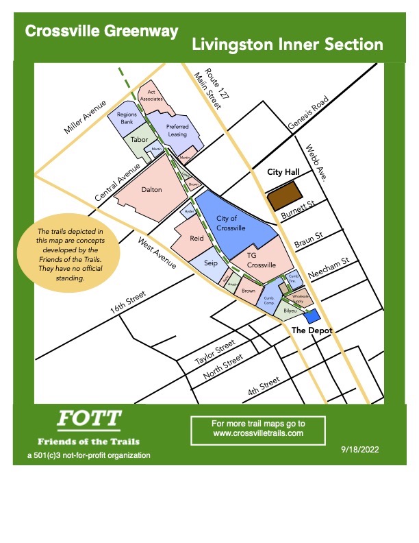
The Livingston Road Segment
This segment will follow the old railway line from the Depot to the Obed River Park.
2.5. The Livingston Road Segment
This Segment starts at the Crossville Depot and follows the route of the old rail line to County Complex and the Obed River Park. It abuts numerous properties but one day we hope it will become a paved cycycle trail.