Hiking in
Cumberland County
Trails of Cumberland County
In 2025 there are over 100 miles of hiking trails in the county, up from 30 miles in 2012, and these trails are well used by residents and visitors. The historical growth of the trails systems in the county shows there is a lot of public support for more trails as evidenced by the number of volunteers who do physical work on the trails, the enthusiasm shown by hikers when new trails are added into the inventory and the enthusiastic participation in the local Hiking Marathon.
Here you will find trail maps, driving directions and trails descriptions for all the hiking trails in Cumberland county. Over 200 miles of hikes are described here.
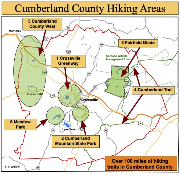
For the purposes of describing trails and hikes, the county is divided into six areas. These areas are listed in this table and can be reached using the buttons above.
Cumberland County Hiking Areas
- Crossville Greenway Trails
- Cumberland Mountain State Park Trails
- Fairfield Glade Trails
- Cumberland Trail
- West Cumberland County Trails
- Meadow Park Trails
Interactive Map of County Trails
This is a new feature we are trying out. Let us know what you think.
We have created a Google “My Map” of Cumberland County and added many of the trails as GPX tracks. We think this is a useful feature as it allows you to zoom in on the trail, get driving directions and use other common features of Google maps. We will be adding more trails and features.
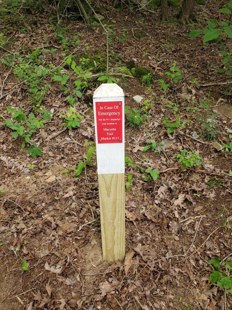
Map of All Emergency E911 Markers
E911 markers are installed at one third of a mile intervals on most trails and this map shows the location of all markers on trails with Cumberland County.
Easy Trails
| 1.1 | Centennial Park Trail (Paved) |
| 1.2 | Woodlawn Loop |
| 1.3 | Little Obed River Trail |
| 1.4 | Woodlawn Loop & Little Obed River Trail |
| 1.5 | TCAT Trail |
| 1.6 | Obed River Park Trail |
| 1.8 | Meditation Trail |
| 1.9 | Habitat Trail |
| 1.11 | Airport South Trail |
| 2.4 | Byrd Lake ADA Trail (Paved) |
| 3.1 | Amherst Trail |
| 3.5 | Central Spine (Paved) |
| 3.6 | Glastowbury Trail |
| 3.11 | Kingsboro/Village Loop (Paved) |
| 3.13 | Library Trail |
| 3.15 | Moss Creek |
| 3.21 | St George Trail |
| 3.24 | Thornhill Trail |
| 5.1 | Lake Alice Trail |
| 5.3 | Adshead Trail |
| 5.4 | Lake Laura ADA Trail (paved) |
| 6.1 | Soldier’s Beach Trail |
| 6.2 | North Trail |
Moderate Trails
Moderate Trails will be listed here.